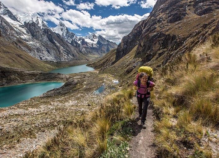
Huayhuash Range

Huayhuash Range

The trail (180 km) begins and ends in Chiquián. Over 12 days, the trail travels along the north side of one of the most beautiful mountain ranges in the world, passing onto its eastern slopes and ending on the west side. The trail leads through a series of snowy peaks, including Yerupajá (6,634 masl) and dozens of lagoons and ravines. The short road (Llamac - Jahuacocha) takes 2 days.
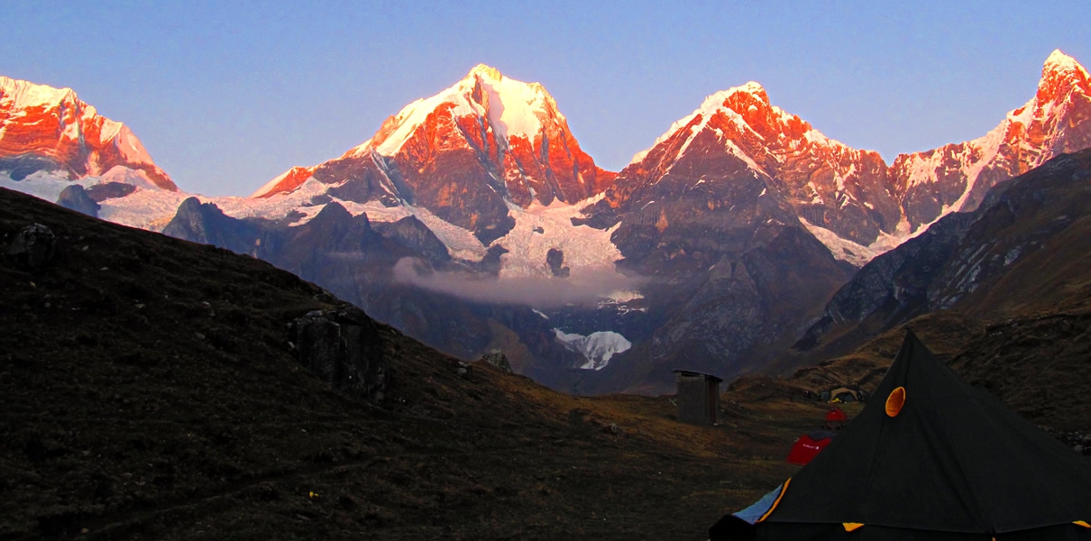

Huayhuash Range

General Information
 
  • Location: Áncash Department. Chiquián (3,090 masl), Bolognesi Province.
  • Weather: Dry and very cold
  • Average temperature: 5 ° C
  • Season: From May to September
  • Access by Land: Lima - Huaraz (400 km), in 8 hours. There is public transport that will take you from Huaraz to Chiquián. (110 km south of Huaraz)
  • Level: High
  • Time: 2 days

Directions

Book Nearby Accommodation

Get Directions

Are you a business owner in Peru?

My Guide Peru, an informative and user-friendly online guide, was created for all those interested in the Peru region.

Used daily by travellers, tourists, residents and locals, powered by Local Experts, our site reaches the people who are your potential customers.

  • WhatsApp Enquiries
  • Integrate your chosen Booking platform
  • Gallery with Videos & Virtual Tours
  • Downloadable PDFs (Menus , Pricing lists..)
  • Event Promotion Included
  • Website Link
  • Social Media links
Find Out More

My Lists

Create New Guide

OR

Mini Guides
Arrow

Login to create your guides for Peru.

Add to My Guide

Create New Guide

Cancel

Cancel

Book Experiences in Peru

Mini Guides

We Are Part of the My Guide Network!

My Guide Peru is part of the global My Guide Network of Online & Mobile travel guides.

We are now in 180+ Destinations and Growing. If you are interested in becoming a local travel partner and would like to find out more then click for more info about our Website Business Opportunity.

Nearby Destinations

Events in Peru

Please select a Date first.

Search for a company in Peru